I made an Augmented World Expo 2014 layer in Layar, an augmented reality app. You can find it by going into Layar, going into Geo Layers, and searchin for “awe 2014” or “augmented world expo”.
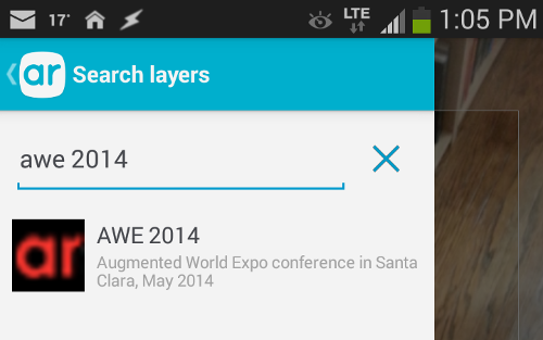
Anyone at the conference can use it to scan around Santa Clara to see two kinds of things: 1) tweets using the #awe2014 hashtag (if the tweets are geolocated so they can be nailed to a point) and 2) points of interest from the shared Google Map I set up. I put a few points of interest into the map, but it’s open to everyone to add more restaurants or sites to see or anything else.
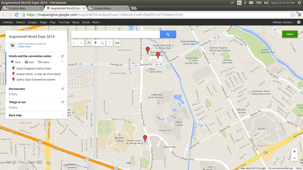
(You need to sign in to Google to edit it … sorry about that. I’ll see about shared editable maps in OpenStreetMap.)
It’s an augmented reality view of Santa Clara for the Augmented World Expo!
It’s done with Laertes, an point of interest provider for Layar meant for conferences and special events like this.